
Map of Australia - Educational Chart
Product Code: CH6300
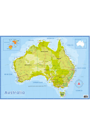
Embark on a geographical journey with our Map of Australia chart. This detailed and informative poster is an essential resource for classrooms, libraries, or any learning space where a curiosity for geography and Australian culture is encouraged.
The chart measures 42cm x 55cm, striking the perfect balance between size and readability. It features a comprehensive map of Australia, showcasing states, territories, major cities, geographical features, and surrounding oceans and seas. The use of colour and clear labelling makes it a practical reference for students of all ages.
With a laminated surface, the map is designed for interactivity and is suitable for use with a whiteboard pen. This allows educators to highlight areas of interest, draw migration routes, mark historical events, or track weather patterns directly on the map, then easily wipe it clean for the next lesson.
Designed and printed in Australia, this map not only supports educational outcomes but also serves as a vibrant reminder of the country's diverse landscapes and rich heritage.
No reviews yet. Write a review.
Be The First To Review This Product!
Help other Australian Teaching Aids users shop smarter by writing reviews for products you have purchased.

